Aerial Survey Company Names New President
Aerial survey company Owyhee Air Research (OAR) has named a new president and announced plans to grow its portfolio of services to include vegetation and water resource mapping as well as aerial inspections by unmanned aircraft.
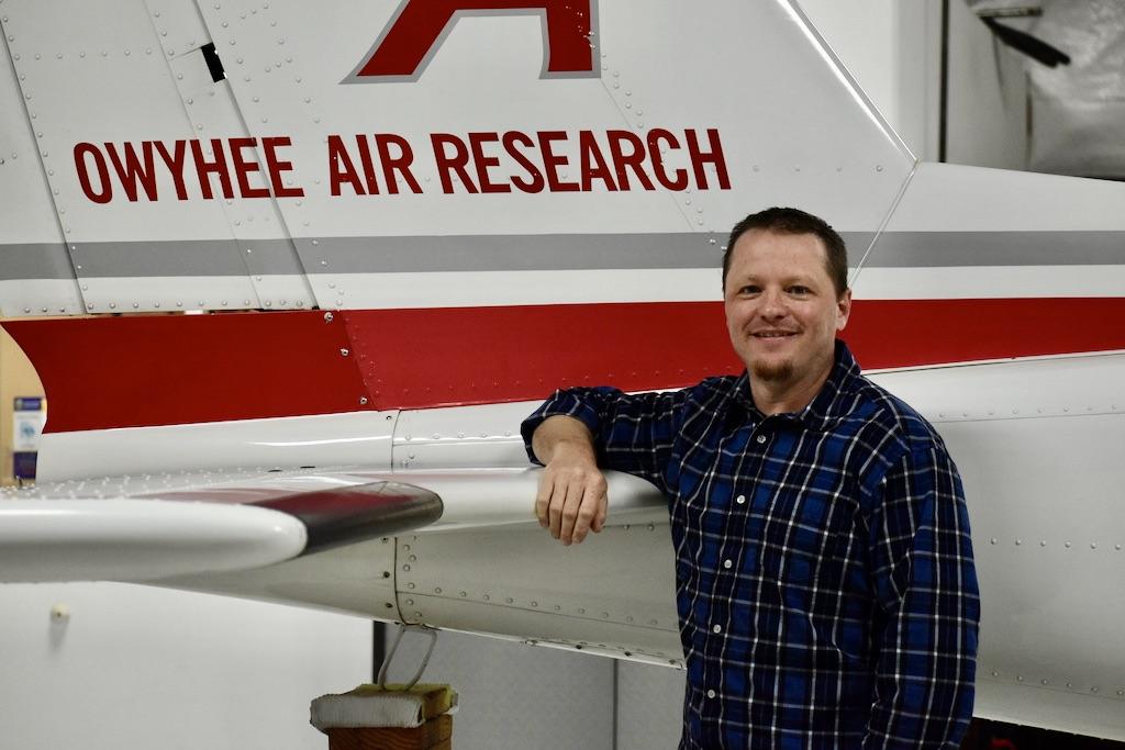
OAR, a Part 135 carrier based at Nampa Municipal Airport (MAN) in Nampa, Idaho, in May named Michael Intschert as its new president. A U.S. Army veteran, Intschert is a licensed commercial pilot with instrument and multi-engine ratings. He received a bachelor’s degree from Embry-Riddle Aeronautical University and a master of business administration degree with an aviation management specialization from Daniel Webster College.
“We are pleased to announce Michael as the new president who will steer OAR to the next chapter as a leading provider of aerial survey and natural resource data collection,” said OAR Partner and CEO Thomas Swoyer Jr. “Not only are we acquiring new aircraft, more sophisticated camera and sensor technologies, and advanced data analytics, but we are increasing our team to be able to expand our services, capabilities, and geographic range.”
OAR operates sensor-equipped Beechcraft King Air B100, Vulcanair P68C and P68 Observer, Maule M7-235 and Cessna 185 aircraft. It works with private, federal, state and local agencies, wildlife biologists and fire managers in the U.S. and Canada to conduct wildlife surveys, fire reconnaissance and landscape mapping.
The company plans to expand its services in aerial data acquisition to include vegetation mapping using multi- and hyperspectral imaging and water resource mapping, such as wetlands and watersheds. OAR also plans to pursue oil/gas pipeline and asset inspections “by aligning partnerships” with unmanned aircraft systems operators.
“OAR is no stranger to natural resource aerial data acquisition, but we see so much opportunity to expand our capabilities to meet the needs of the industry with remote sensing,” said Intschert. “Our new aircraft and sensor technologies provide faster and more actionable data services across a larger geographic footprint with sharper imagery.”
Related Content